|
Update on Project Activities
On Wednesday before class, the group met with Deland to review our potential for community outreach. In last week’s reflection, we expressed concern that the nature of our project would make interaction with the community difficult; after our meeting with Deland, we felt reassured that our goal to attend bi-weekly community meetings and share our research with these communities. With this in mind, our met with Aaron Aknin on Thursday morning and discussed some of the current issues in Palo Alto, what the planning department is investigating, and how our work could be of utility to their efforts. Specifically, we hashed out some ideas of potential research questions for our TDM study. For our study, we will be looking mainly at the funding mechanisms of independent third-party TMAs, how existing businesses can be enticed into the program, and how to maintain social equity within the TDM. With this framework in mind, we can make a more focused search and obtain more useable results. Finally, we visited Patricia during her office hours and worked together to learn how to add our Census data into GIS successfully. So far we completed the most recent ACS study for the three counties, and with this guide in mind, we now will do this with the 2000 and 1990 Census data for San Mateo, San Francisco, and Santa Clara counties. What We Observed and Learned With our project now in full swing, significant headway was made this week addressing all facets of our scope. On Monday, Marisa Raya, a guest speaker from the Association of Bay Area Governments (ABAG), came to class to present on Plan Bay Area, a long-term land-use, housing, and transportation plan for a sustainable metropolitan region. Several themes from Marisa’s presentation pertained to our work. Through their Plan, ABAG hopes to reduce vehicle carbon emissions by encouraging urban density and transit, bike, and pedestrian infrastructure. Unfortunately, ABAG as an organization lacks the legal authority to enact this zoning and policy. Moving Forward Our first internal deadline-- complete downloading all of our data-- is being steadily worked on. We have learned how to transform the Census data into GIS maps, and are working steadily on creating the maps of mode share for individuals nearby Caltrain station. On the TDM front, we know now how we will be quantifying success, and can search for programs we evaluate to address our desired goals. Next week, we will also be meeting with Adina to discuss potential sources of employment data (for the maps which cover those who work near the Caltrain stations), and our progress thus far. Update of Project Activities
After completing our “Scope of Work” last week, we have spent this week focused on taking the foundational steps to move the project forward and preparing to truly start getting involved with the Fair Oaks Health Center and the surrounding North Fair Oaks Community. As defined by our “Scope of Work,” our goals for Week 5 were to build our survey for the Fair Oaks Health Center patients, staff members, and North Fair Oaks community members. In addition, we wanted to plan the logistics of conducting a focus group with the Fair Oaks Health Center staff members, and work with Priscilla to set up a focus group or individualized interviews with a few patients as well so we have detailed anecdotal data to supplement the more quantitative data we receive through the survey. After conducting several drafts of the survey on our own, we have sent a version of the survey to Priscilla for her review, so that we will be prepared to start testing the survey next week. In addition, we have worked to identify times for focus groups, and are in the process of contacting Priscilla regarding the scheduling and logistics (including identifying how many patients and staff we should try to talk to, and developing a flyer and incentivizing these individuals to come) for these two sessions. This work around the survey and focus groups was the main milestone for Week 5, but we have also been in the process of working towards other future milestones as well. We have focused on collecting more information around setting up farmers markets in low income communities, including following up with Collective Roots (after an interview conducted last Friday) about the East Palo Alto Farmers Market and the idea of a partnership between Collective Roots or another similar nonprofit organization and the Fair Oaks Health Center to guide the new farmers market management. Our contact at Collective Roots will be proposing the idea of a partnership with the Fair Oaks Health Center to the Collective Roots staff in their team meeting on Monday and getting back to us, so we will know whether or not to contact Priscilla about this idea– which is something she mentioned she would be interested in–early next week. Our efforts to gather the necessary information to move forward with this project have also included making phone calls to the SMC Ag Commission with questions about the application and required maps, and brainstorming a list of data points we hope to collect through GIS/Business Analyst, so we are well prepared to utilize this resource and can set up an effective meeting with Patricia Carbajales. What You Observed and Learned This week, the most important new insights we gained came from the interviews we have done in an effort to find out more about farmers markets in similar communities. In our call to Collective Roots, our contact emphasized many of the challenges they have faced, and made it clear that the management of even a small farmers market takes a great deal of time in order to incentivize both community members and vendors to participate so that the market stays financially stable. Interesting incentive programs used by Collective Roots include a “Double Bucks” program, where Collective Roots matches dollars up to $20 per month for families who use WIC or food stamps at the farmers market and a CSA program where Collective Roots buys bundles from the vendors and sells to individuals outside of EPA with a higher purchasing power and willingness to pay to make the market worthwhile for the vendors. Although these programs do incentivize participation and insure greater revenue at the market, the administration of these programs takes a lot of work. We learned that the operation of the EPA Farmers Market (which has only 2-3 vendors) takes 20 hours a week dedicated by a Market Manager, and 12 additional hours added by other staff members working on market management, publicity, and incentive programs. Although a bit discouraging, this information will be incredibly useful when we work with Priscilla to determine the Fair Oaks Health Center’s plan for market management, since before Priscilla was unsure as to who would be responsible and how much time they would need to dedicate. In addition, Collective Roots will be getting back to us about whether they might be interested with partnering with the FOHC in the establishment of the farmers market, so we may be able to report back to Priscilla with this as an option for market management. This interview with Collective Roots was also particularly useful in informing our survey drafts. For example, we learned that the East Palo Alto Farmers Market, which has moved several times, has been most successful at the Ravenswood Health Clinic, but Collective Roots have found that the clinic staff really haven’t participated in the market at all, so it will be important for us to make sure to ask whether each respondent is a patient or staff member so we know whether the staff are willing to support and attend this farmers market. Overall, the information we have gathered from Collective Roots, Jerry Lami the Executive Director of the West Coast Farmers Market, and the SMC Ag Commission has been very helpful in preparing us to take the next steps in our community outreach. Critical Analysis In class this week, our discussions and readings about Plan Bay Area tied in to our project through because North Fair Oaks is one of the locally-nominated Plan Bay Area priority development areas. We learned that North Fair Oaks has received planning funding from the Metropolitan Transportation Commission intended for funding their updated community plan. This information provided us with more context information around what resources are behind the community of North Fair Oaks currently, and the context around the inspiration for the current North Fair Oaks Community Plan, which in fact recommends a farmer’s market. We appreciated the opportunity in class this week to reflect on our identities, the negative impact of making assumptions, and the importance of bridging differences. Following the discussion led by Carly, we found ourselves reflecting on the commonly-held assumptions that farmers markets are for wealthy people, and thought about how best to approach community members so that they feel that the farmers market would be inclusive and inviting. In negotiating how best to approach community members when we enter the health center to conduct surveys, one concern that came up was what language to address the patients in, since 70% of the patients are monolingual Spanish speakers, but we also don’t want to make assumptions (especially wrong assumptions) about what language each individual patient speaks. We are thinking that the best thing to do will be to ask if they prefer Spanish or English (in Spanish since a majority are Spanish speakers) as we approach, then go with whatever language they are most comfortable with. We appreciated the insight in class that this first contact will not be the most important part of the conversation, and that instead we need to focus on building trust and showing respect throughout the rest of the conversation, once the patient has identified what language they wish to converse in. Descriptive
We’ve crossed the halfway mark in our quarter and gained momentum on our Golden Gate project - our introductions to Plan Bay Area by Marisa Raya on Monday, to the California Environmental Quality Act (CEQA) by Deland on Wednesday, and participation in Carly’s ‘Brave Space’ workshop circle soon thereafter allowed us to further consider both the greater sustainability implications of our efforts in this class and the importance of reflecting on identity politics in service learning contexts. Marisa Raya presented us with Plan Bay Area’s goals and current progress, emphasizing, as she put it, that it was created to be a “tool for democratic decision making.” The Plan sought to embody the visions of individual regions’ communities and organizations, a commendable goal that she acknowledged had its own difficulties and contradictions. Some of these complications included lawsuits filed against Plan Bay Area and others evoking CEQA. We were able to review in class Wednesday how we may best organize our service learning experiences in accordance with sustainability - defining the community members and individuals we serve as well as taking advantage of pressure points. Carly helped moderate a class discussion on the most sensible and genuine ways to approach different individuals in service learning projects. We’ve come to correspond with more community partners thanks to Deland, Janice, and Dyanna’s help getting us in touch directly with SF Youth Commission, Walk San Francisco, San Francisco Planning and Urban Research (SPUR), La Playa/Great Highway Neighborhood Watch, Outer Sunset Merchant & Professional Association, Java Beach Café, and 45th Avenue Neighborhood leaders. Though the rainy weather forced us to cancel our series of Golden Gate Park interceptor surveys scheduled for Friday morning, we still took the opportunity to meet and make use of the lessons we picked up on in class during the week. We emailed all of our community partners and finalized the majority of our online surveys for contacts recommended to us by Supervisor Tang’s office. We created tailored surveys for Java Beach Cafe Patrons, Outer Sunset Merchant & Professional Association, 45th Avenue Neighbors, and La Playa/Great Highway Neighborhood Watch. Interpretive As we engage in our classwork and research, we continually must bring ourselves back to some key guiding questions of our project. These include: ● What communities are we serving and how can we best serve them? ● How do the principles of sustainability relate to and shape our project? ● How can we best connect the work we do in the classroom with our field work, outreach, and project goals? These past weeks have been instrumental in addressing some of these questions. The class session on community outreach helped us define our own strategies for engaging with our respective communities. We realized that we must be careful to not use the word “community” as a blanket term and must be aware of the many different community groups and individuals we are interacting with. For example, the residents of the Sunset District are a separate community than the members of the SF Bike Coalition and we must be mindful of these distinctions. We were particularly inspired by the three-step outreach process of the Broadway Street renewal and, in crafting our own project, are emulating a similar process. Continuing in the vein of outreach, we were moved and inspired by the Open Spaces talk about assumptions and left with a feeling of appreciation for both the safe space that was created in the classroom as well as insight as to how this idea applies to our project. Reflecting on the assumptions that could arise in our work allowed us to proactively analyze potential issues and misunderstandings. This reflective activity ties into the larger theme of service learning as a continual and mutual learning process. To that end, we have taken the skills we learned in class regarding outreach and have devised a number of surveys to disseminate to different community organizations. These include the SF Bike Coalition, the La Playa/Great Highway Neighborhood Watch, the Outer Sunset Merchant & Professional Association, the Java Beach Cafe, and the 45th Avenue Neighbors. We were sensitive in customizing the survey for each group, with our overarching theme being to discern transit and access patterns to Golden Gate Park. We realized the complexity of working with varying interest groups. One point that was reiterated from our class discussion was the use of the Stanford name: we were hesitant to immediately qualify ourselves as Stanford students because of the weight that name carries. We ultimately decided to introduce ourselves as students and then add Stanford in after when talking about the Sustainable Cities class. We found this to be the most inconspicuous and respectful method when engaging with community groups. Shifting to a more comprehensive picture, the lessons on Plan Bay Area and some of the policies driving development helped us situate our project in a larger context. Literally, we realized the environmental review process this project or other development initiatives would have to undergo in order to be realized and what a lengthy process this can become. However, we found it even more important to remember the scope of our project and not become too myopically engaged in each individually designed entrance to the Park without considering the larger neighborhood and regional consequences. As we approach the design phase of our project, we realize the importance of justifying our design recommendations based on a well-researched knowledge of the many stakeholders and regulations at play. We are very grateful for all the contacts with whom Janice has put us in touch. They will be invaluable in providing expert information and recommendations. Unfortunately, we were not able to go into the city this Friday due to weather concerns, but we have rescheduled this visit for next week. We do not believe this puts us under a serious time constraint, although we of course are remaining mindful of the rapidly passing quarter. We have set deadlines for ourselves that we continue to reassess as necessary. Overall, we would describe this week as an administrative one in which we tackled many emails and survey distribution electronically. We are excited to get back into the field again next week. Applicative With our new contacts such as Commissioner Persky of the SF Youth Commission and Nicole Schneider of Walk San Francisco, we will be able to take the valuable feedback they provide for us and use it to improve our design methods and approach. Marisa Raya of Plan Bay Area, also opened our eyes to issues in renovation/building in communities that are already comfortable with their current living conditions, or wish for something else to be implicated other than what we plan. We will be addressing this potential issue by constant interaction with our Community Partner Janice Li, and members of organizations that are heavily involved in the community such as Commissioner Nicholas Persky of the SF Youth Commission and Nicole Schneider of Walk San Francisco. Another tool from this week that will prove very valuable to us was Carly’s ‘Brave Space’ circle. Providing tremendous insight as to how we should go about conducting surveys and interacting with the people of Sunset District and its surrounding communities, we were able to look at our project through the lens of individual potential emotion and possible desires of the community members we will be interacting with. We learned that it is extremely important to take into consideration how we may come across to the people we survey and interact with, i.e., whether or not we show genuine interest and care for their community and the project, how well we can relate to them, and being conscious of some biases that may be there, but eliminating it from interaction. For our project, we are well aware that we will be talking to and interviewing a wide variety of people with extremely different backgrounds, thus we will look at finding common ground with the people we survey to show we have a genuine interest in helping them and their community rather than coming across as wanting to take over without respect to their desires. We will also be conscious of time commitments and will make the surveys and interviews relatively brief. As mentioned before in the descriptive portion of this reflection, we were not able to go to the city today, but we did gain some ground and are moving forward. Taking the opportunity to reply to and request feedback from community organization members that have reached out to us and are willing and eager to help us will prove of great importance to our project. As mentioned before, we will be able to use their expertise and experience to enhance or project ideas, implications, and direction as soon as we receive the feedback. We also took today as an opportunity to customize and send out surveys to contacts recommended by Supervisor Tang’s office including: Java Beach Cafe Patrons, Outer Sunset Merchant & Professional Association, 45th Avenue Neighbors, and La Playa/Great Highway Neighborhood Watch. With the information we gather from these contacts we will be able to look at how dangerous nearby community members to Lincoln Way feel the street is, and what they wish to see implemented to increase the safety on this street. We will be heading into this coming week with hopefully a strong base of knowledge collected via the surveys sent out to the recommended contacts and ready to conduct interceptor surveys in the park and meet face to face with community organizers and organizations on Sunday, February 16th. Update of Project Activities
This week, Sam and Ma’ayan finalized their scope of work and began data collection. As with all procedures on GIS, our work will likely take us ~4 times as long to complete as we expect it to, so we decided to get a head start on our data collection and cleaning process. After many arduous hours meeting with each other and Patricia in Branner Library, yesterday Ma’ayan met with Kris, the Government Information Librarian in Green, and she explained how to find and download the data that we need from the Social Explorer website. Now that we have the process, and site down, we need to make sure the GEO_FIPS codes correspond from the Social Explorer data and our desired shape files. After we confirm this, we can begin to download our data en masse and map it out! In addition, we met with Adina on Thursday and discussed our final deliverables and how they will be used to get a better sense of our project goals. In this case, the maps will be used to test whether mode shares have historically changed since 1990. This will show Caltrain not only the past, and current, mode share amounts, but will also give us a better sense of the potential mode share shifts that are possible to achieve through TDM programs, employer incentives, and policy tools-- which is where the second deliverable, the TDM report, comes in. This discussion and gave us more ideas on how we shall be visually organizing our map. We haven’t finalized the design, but once we get the data and start mapping it, we will have a better sense of the different kinds of narratives we can show through our maps. While at first, we were struggling to find our data, with the support of some Stanford staff, we have found the relevant Census data from 1990, 2000, and ACS data from 2011. With this, we will be able to effectively communicate trends and changes. We are hoping to find some reliable estimation data to project future changes, but is an extension for our project if we complete it with time to spare. The projection aspect could also be where someone could pick up from our project and continue our work. What We Observed and Learned During the weekend, Ma’ayan and Sam reviewed a Caltrain annual rider survey with 2900 responses conducted in July that asked riders their thoughts on Caltrain’s performance and suggestions for future improvements. Seeing this extensive research and the results the study garnered, we decided that for the sake of our research questions and scope of work, we would not conduct similar intercept surveys, as we initially believed. Upon seeing the other student presentations, we realized since we were missing this survey component, we were lacking elements of community interaction that are pivotal to service learning. In our meeting on Thursday, Adina mentioned a variety of different events and sessions happening around the Bay Area right now that are related to our project (EIR public readings, forums at SPUR, various relevant city council meetings). With this in mind, we decided that for our project, each of us will attend one of community meetings/ panels every other week. In addition, upon completing our research, we will also write letters explaining our findings to various city councils and working groups addressing the issues we are focused on. Since a huge component of our project is public outreach and spreading the results of our work to as many people as possible, these letters will serve a pivotal role. Moving Forward Today we will be editing and formatting our scope of work, and submitting it to Deland, Carly and Adina tonight. In addition, next week we have our meeting with Aaron Aknin from Palo Alto to discuss current traffic problems and potential solutions Palo Alto is currently investigating to solve them. We will inform him on the nature of our project as well, and see if he has any resources which could be of use to us. In addition, we will be collecting our data and starting to compile our map within the next week. Accordingly with our self-set goals, we will be deciding which TDM programs and municipalities to study for our final report this week. 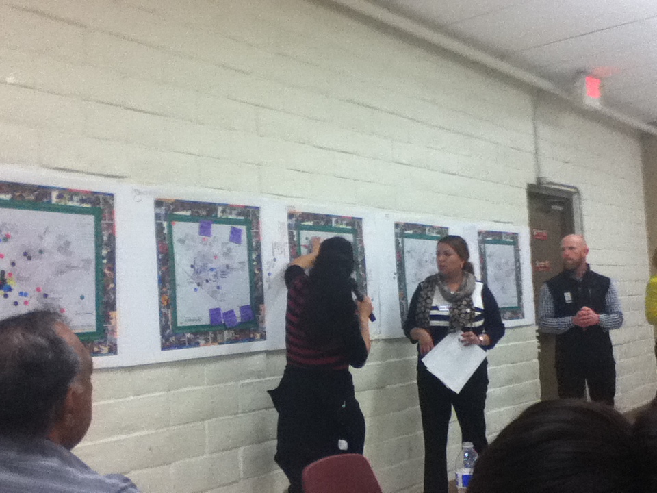 Update of Project Activities
This week, we finally left The Farm. I (Pete) attended a community meeting at the Fair Oaks Community Center. The meeting was organized by the Fair Oaks Forward Parks Working Group. The Parks Working Group, of which Priscilla is a member, is developing ways to fulfill the North Fair Oak’s Community Plan’s goal of increasing green space and community gardens. There is a clear nexus between these efforts and the goals of our farm stand project. The following day, Natalie and Sophie toured the Fair Oaks Health Center (FOHC). They stood in the parking lot, on the very asphalt that may one day host vendors of local, healthy produce. Other major tasks for the week included finalizing our Scope of Work, drafting a survey for FOHC patients and staff, and conducting phone interviews with Collective Roots and the West Coast Farmers Market Association – two organizations which operate farmers markets at health facilities on the Peninsula. Observations and Learnings At the community meeting, I was able to watch community planning in process. County officials reported on concepts for redesigning several blocks of Middlefield Road in the heart of NFO. Representatives from the Trust for Public Land presented some ideas for how parks can transform communities and then introduced a participatory mapping exercise. Community members divided up according to the section of NFO in which they resided. Each table had a map of the area. Community members placed stickers to mark where they lived, where they played, places they loved, places about which they had concerns, and places where they’d like to see parks. In the discussion that followed several themes emerged. For instance, there was consensus that fields at the Fair Oaks School, which community members have access to after school hours through a joint use agreement, need more public restrooms. On their visit, Natalie and Sophie were able to see the physical layout of the FOHC campus. Priscilla showed them an outdoor patio that could potentially provide a space for farmers market-related events, as well as a conference room where we can conduct our focus groups with staff. The health center, which just opened in December, boasts a dental clinic, a wellness center, and adult and child primary care among other services. Critical Reflection On Tuesday night, I hopped on my bike outside the law school and started navigating rush hour traffic towards the Fair Oaks Community Center. I went a long way in six miles. Middlefield Road took me through Atherton. I always know when I’m in Atherton because of the walls that surround the properties. Forbes recently named Atherton the most expensive housing market in the nation. The median housing price is $6.67 million. Atherton, Menlo Park, and North Fair Oaks were all part of what was called Fair Oaks, until the early 1900s when the first two incorporated. North Fair Oaks remains unincorporated. I knew when I had entered NFO because the walls disappeared, the trees thinned, and the street came to life. Businesses, many with signs in Spanish, shed as much light as the occasional street lamps. I started walking my bike along the curb, in part to see what I could see, in part to avoid being terribly early, and in part because the bike lane had disappeared. I passed auto body shops, pay day lending operations, corner stores, liquor stores, a supermarket, taquerias, pupuserias, and – incongruously, immediately before the Dumbarton Spur – the lonely Connoisseur Coffee Company. A Costco sits next to the Community Center. I wondered who shops there. At the community meeting, Priscilla and the other organizers were anxious, wondering if residents would show up. Folks trickled in. Some took headsets to listen to the live translation. No one touched the snacks until the end, which required some restraint on my part. I distributed stickers and took notes and tried to make eye contact and smile. I thought about the string of meetings that preceded this one and the string of meetings that would follow. I was looking at the raw materials of community planning: a mix of heady ideas, mundane details, disagreement, and hopefully consensus and change. It was a good night. |
Archives
November 2020
Categories
All
|
 RSS Feed
