|
Update of Project Activities
This week, Sam and Ma’ayan finalized their scope of work and began data collection. As with all procedures on GIS, our work will likely take us ~4 times as long to complete as we expect it to, so we decided to get a head start on our data collection and cleaning process. After many arduous hours meeting with each other and Patricia in Branner Library, yesterday Ma’ayan met with Kris, the Government Information Librarian in Green, and she explained how to find and download the data that we need from the Social Explorer website. Now that we have the process, and site down, we need to make sure the GEO_FIPS codes correspond from the Social Explorer data and our desired shape files. After we confirm this, we can begin to download our data en masse and map it out! In addition, we met with Adina on Thursday and discussed our final deliverables and how they will be used to get a better sense of our project goals. In this case, the maps will be used to test whether mode shares have historically changed since 1990. This will show Caltrain not only the past, and current, mode share amounts, but will also give us a better sense of the potential mode share shifts that are possible to achieve through TDM programs, employer incentives, and policy tools-- which is where the second deliverable, the TDM report, comes in. This discussion and gave us more ideas on how we shall be visually organizing our map. We haven’t finalized the design, but once we get the data and start mapping it, we will have a better sense of the different kinds of narratives we can show through our maps. While at first, we were struggling to find our data, with the support of some Stanford staff, we have found the relevant Census data from 1990, 2000, and ACS data from 2011. With this, we will be able to effectively communicate trends and changes. We are hoping to find some reliable estimation data to project future changes, but is an extension for our project if we complete it with time to spare. The projection aspect could also be where someone could pick up from our project and continue our work. What We Observed and Learned During the weekend, Ma’ayan and Sam reviewed a Caltrain annual rider survey with 2900 responses conducted in July that asked riders their thoughts on Caltrain’s performance and suggestions for future improvements. Seeing this extensive research and the results the study garnered, we decided that for the sake of our research questions and scope of work, we would not conduct similar intercept surveys, as we initially believed. Upon seeing the other student presentations, we realized since we were missing this survey component, we were lacking elements of community interaction that are pivotal to service learning. In our meeting on Thursday, Adina mentioned a variety of different events and sessions happening around the Bay Area right now that are related to our project (EIR public readings, forums at SPUR, various relevant city council meetings). With this in mind, we decided that for our project, each of us will attend one of community meetings/ panels every other week. In addition, upon completing our research, we will also write letters explaining our findings to various city councils and working groups addressing the issues we are focused on. Since a huge component of our project is public outreach and spreading the results of our work to as many people as possible, these letters will serve a pivotal role. Moving Forward Today we will be editing and formatting our scope of work, and submitting it to Deland, Carly and Adina tonight. In addition, next week we have our meeting with Aaron Aknin from Palo Alto to discuss current traffic problems and potential solutions Palo Alto is currently investigating to solve them. We will inform him on the nature of our project as well, and see if he has any resources which could be of use to us. In addition, we will be collecting our data and starting to compile our map within the next week. Accordingly with our self-set goals, we will be deciding which TDM programs and municipalities to study for our final report this week. 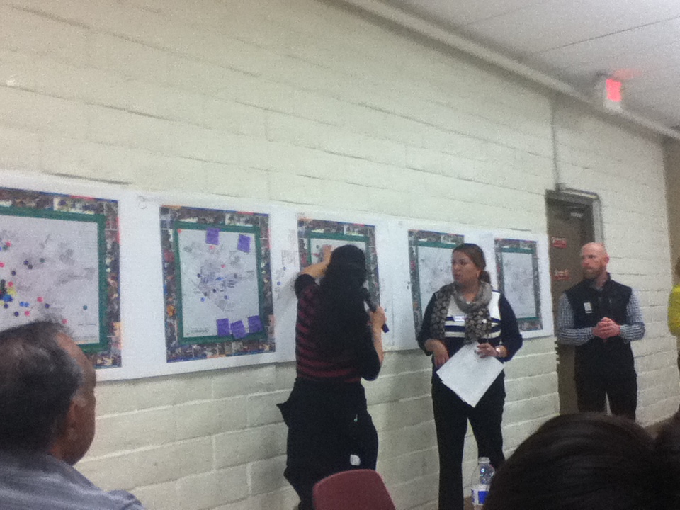 Update of Project Activities
This week, we finally left The Farm. I (Pete) attended a community meeting at the Fair Oaks Community Center. The meeting was organized by the Fair Oaks Forward Parks Working Group. The Parks Working Group, of which Priscilla is a member, is developing ways to fulfill the North Fair Oak’s Community Plan’s goal of increasing green space and community gardens. There is a clear nexus between these efforts and the goals of our farm stand project. The following day, Natalie and Sophie toured the Fair Oaks Health Center (FOHC). They stood in the parking lot, on the very asphalt that may one day host vendors of local, healthy produce. Other major tasks for the week included finalizing our Scope of Work, drafting a survey for FOHC patients and staff, and conducting phone interviews with Collective Roots and the West Coast Farmers Market Association – two organizations which operate farmers markets at health facilities on the Peninsula. Observations and Learnings At the community meeting, I was able to watch community planning in process. County officials reported on concepts for redesigning several blocks of Middlefield Road in the heart of NFO. Representatives from the Trust for Public Land presented some ideas for how parks can transform communities and then introduced a participatory mapping exercise. Community members divided up according to the section of NFO in which they resided. Each table had a map of the area. Community members placed stickers to mark where they lived, where they played, places they loved, places about which they had concerns, and places where they’d like to see parks. In the discussion that followed several themes emerged. For instance, there was consensus that fields at the Fair Oaks School, which community members have access to after school hours through a joint use agreement, need more public restrooms. On their visit, Natalie and Sophie were able to see the physical layout of the FOHC campus. Priscilla showed them an outdoor patio that could potentially provide a space for farmers market-related events, as well as a conference room where we can conduct our focus groups with staff. The health center, which just opened in December, boasts a dental clinic, a wellness center, and adult and child primary care among other services. Critical Reflection On Tuesday night, I hopped on my bike outside the law school and started navigating rush hour traffic towards the Fair Oaks Community Center. I went a long way in six miles. Middlefield Road took me through Atherton. I always know when I’m in Atherton because of the walls that surround the properties. Forbes recently named Atherton the most expensive housing market in the nation. The median housing price is $6.67 million. Atherton, Menlo Park, and North Fair Oaks were all part of what was called Fair Oaks, until the early 1900s when the first two incorporated. North Fair Oaks remains unincorporated. I knew when I had entered NFO because the walls disappeared, the trees thinned, and the street came to life. Businesses, many with signs in Spanish, shed as much light as the occasional street lamps. I started walking my bike along the curb, in part to see what I could see, in part to avoid being terribly early, and in part because the bike lane had disappeared. I passed auto body shops, pay day lending operations, corner stores, liquor stores, a supermarket, taquerias, pupuserias, and – incongruously, immediately before the Dumbarton Spur – the lonely Connoisseur Coffee Company. A Costco sits next to the Community Center. I wondered who shops there. At the community meeting, Priscilla and the other organizers were anxious, wondering if residents would show up. Folks trickled in. Some took headsets to listen to the live translation. No one touched the snacks until the end, which required some restraint on my part. I distributed stickers and took notes and tried to make eye contact and smile. I thought about the string of meetings that preceded this one and the string of meetings that would follow. I was looking at the raw materials of community planning: a mix of heady ideas, mundane details, disagreement, and hopefully consensus and change. It was a good night. 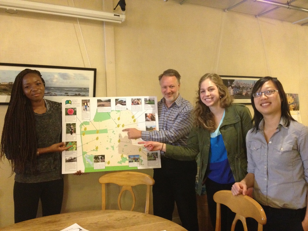 Descriptive After having spent a productive, informative, and fun day in San Francisco with Janice, we feel a lot much knowledgeable about the scope and vision of our project. We had the unique opportunity of engaging firsthand with our project site and various stakeholders who shared their input about and experience with access to Golden Gate Park. Here is a descriptive itinerary of our day:
 2. Next, we walked through Hayes Valley to the office of Parks Alliance, where we met with Steve Schweigerdt, the Development Associate for Parks Alliance. He gave us a detailed overview of the work that his organization does and the structure of their programs and outreach. The Parks Alliance is the result of a union of two other organizations: the Parks Trust, which had a philanthropic focus, and the Neighborhood Parks Council, which was a parks advocacy group. Parks Alliance combines qualities of both of these to be a steward for both policy and parks operation. We heard about lots of the initiatives Parks Alliance is involved with, such as Street Parks, Park Partners, Hidden Garden Steps, community gardens, the Playground Initiative, Pavement to Parks, and Green Connections. While Parks Alliance’s focus is not necessarily on park access and circulation, it was very helpful to hear about what a powerful parks advocate had to say about the current state of SF parks, and the conversation inspired us to think about creative ways we could partner with Parks Alliance to improve the stretches of the park around the blighted Lincoln Way entranceways. 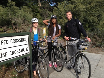 3. After grabbing lunch in Hayes Valley, we picked up our rental bikes at Patricia’s Green and began our bike tour through the Wiggle. It was surprisingly easy to follow the route because of the green “sharrows,” but some of the steep downhill portions of the ride and a few major intersections, such as Octavia and Market, were navigational challenges. While we rode, we noted our levels of comfort depending on the provision of bike lanes and the amount of surrounding traffic. The area from the Panhandle to Golden Gate Park was especially tricky to maneuver. Lucky we had Janice with us or we would have been completely confused by the route! This goes to show how biking in SF is hardly intuitive. On our ride we met up with Ramon Solis, a former intern with SFBC who is still involved in the organization in some capacities. He rode with us for a while and we got to hear about his experience as an intern as well as a lifelong resident of the Sunset District. He explained how the demographics of Sunset are majority Asian and working-class families, and how he think political activism and a sense of community are largely lacking from the neighborhood. This may be a challenge for us as we try to engage more community members and potentially interview people who live on or near Lincoln Avenue.
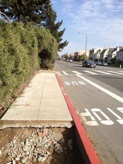
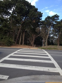
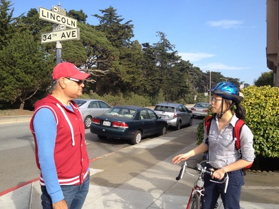
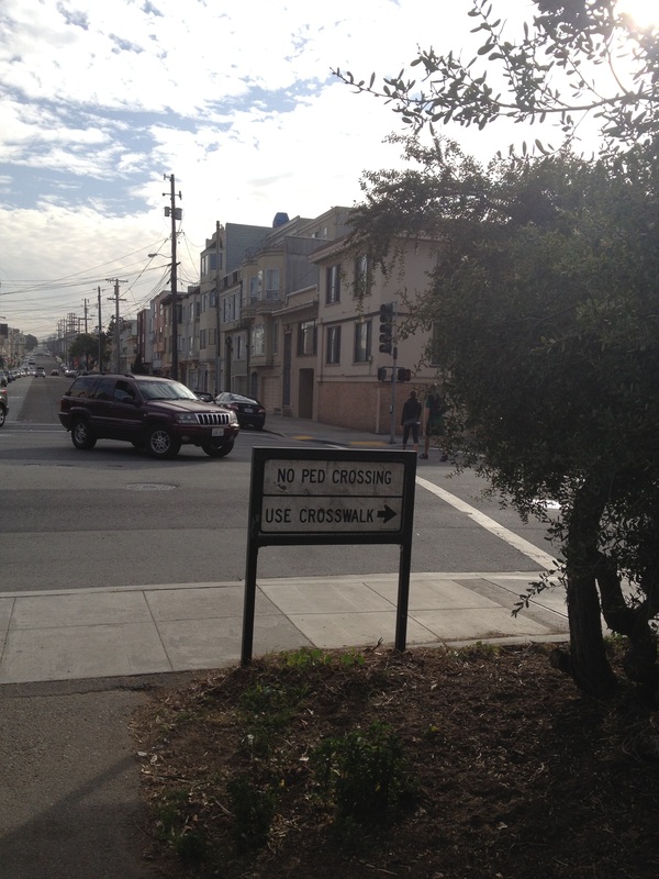
Interpretive It is safe to say that biking in San Francisco is a difficult task: in today’s tour we became well aware of the task. We also were able to experience firsthand the problem our project is looking to address, the entrance ways, especially on Lincoln Ave. Some of Alex Cain’s major points include: 1. The crosswalks leading up to many entrance ways on Lincoln Ave. are extremely dangerous and have proven so with multiple bike/car related accidents. ● This is a major issue that we must look to address, these crosswalks serve as a main port into the park and are not properly highlighted to promote the safety of bikers and pedestrians alike. 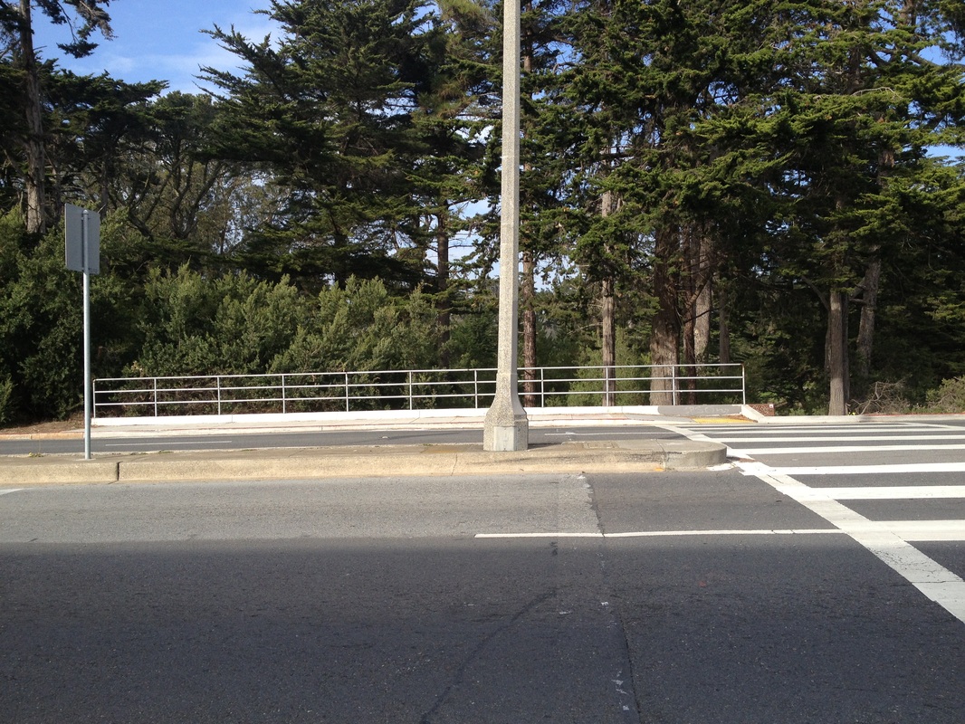 2. The landing strips of sidewalk that accompany these crosswalks, in a lot of places, do not exist, and where they do are extremely small. This holds true to bus stops on Lincoln Ave. as well. ● This is an important issue to address because the average speed of the cars that pass is roughly 40-50mph, residents need a safe place to gather before attempting to cross the street in either direction. Also, if there were a back up of people, as Alex mentioned, there is not a safe place for a lot of people to stand, thus meaning either people are having to stand in the road or rush through the NARROW entrance ways. 3. Overall car and pedestrian awareness of how to cross the street and what to look for. ● Alex informed us that many cases of accidents have occurred simply because the people crossing the double sided street are not aware of how to do so. There is an island in the middle of Lincoln Ave that serves as a median between the lanes of traffic, most people are not aware of the fact that they must stop in the island to make sure the cars coming in the opposite direction do in fact see them. ● Janice pointed out to us that even though the cars on the side from which pedestrians are crossing notice someone is trying to cross and stop, the cars on the other side headed in the opposite direction are not looking at the pedestrian side of the street. Inside of the park bicycling can also become very difficult, as there are places in which there are no bike lanes, no crosswalks, narrow sidewalks, etc. A primary example Janice highlighted to us was the MLK entrance way did not actually provide a crosswalk for pedestrians inside of the park, to use a crosswalk, it required us to walk down to Lincoln Ave. and cross there. ● There is an obvious “flow” issue for both car traffic and pedestrian traffic that must be addressed in the park to make it a safer place for everyone. Overall, as a group today we were able to determine that the issue we need to address foremost are the entrances and crosswalks that span across Lincoln Ave. The entrances and platforms before entering the park are simply too small and poorly advertised, and the crosswalks are far too dangerous with little signage for such a large street and port into the park. 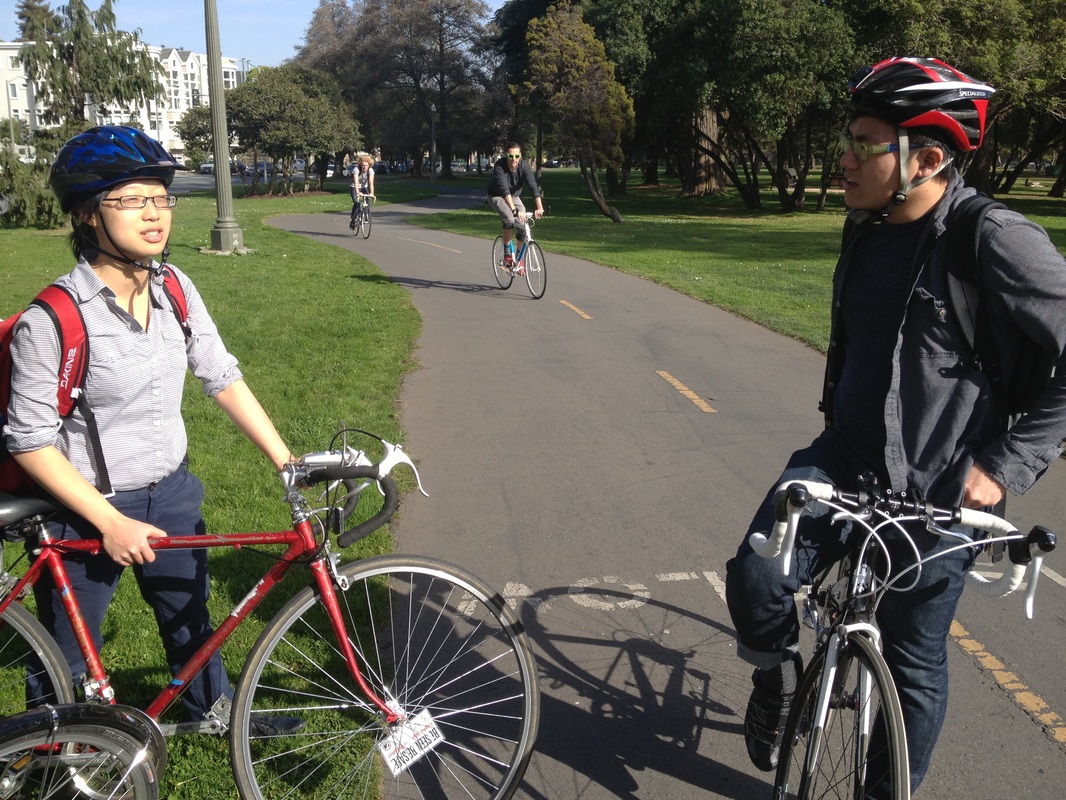 Applicative
Visiting San Francisco today left us well prepared to work on outreach and devising a survey for affiliates of Golden Gate Park and both pedestrian and bicyclist advocacy groups in order to continue gathering information for ameliorating park access. Having met with Supervisor Tang in City Hall, Steve Schweigerdt at the Parks Alliance office, and Alex Cain at the intersection of 34th and Lincoln, we have a reinforced sense of the wealth of resources available to us and the vested interest citizens of San Francisco have in finding creative and effective solutions to the hazardous park entrances. Our first order of business for the week to follow is to compile a thorough list of the variety of programs mentioned by Janice, Supervisor Tang, and Steve in order to create targeted survey questions for organizers and members willing and available to speak to us over the course of the next two weeks. At Supervisor Tang’s recommendation, we will reach out to Walk SF to better understand the pedestrian experience at the Park entrances. Steve mentioned to us that Park Alliance helps fund over 100 neighborhood improvement projects, many of whom will prove resourceful in better understanding the needs and desires of constituents, and converting those interests into potential plans to which each may successfully contribute. Janice was magically able to pull together an incredibly thorough excursion into City Hall and Park Alliance, as well as through the city and the park, over the span of only two to three days. Planning another visit in two weeks will allow us to meet other relevant parties, as well as revisit and spend more time in Golden Gate Park. We will create a survey for pedestrian, cyclist, and vehicle operating visitors of the park who have gone through a variety of park entrances. Janice will forward a survey specifically for SFBC members in time for our visit to the SFBC office, so that we may have a more comprehensive impression of their daily or weekly experience along the nine-mile bike route to and through the park. Our day today also gave us a better grasp of our long-term goals and final deliverable. We have a wealth of notes, photos, and video material for next week’s midterm presentation, and will be able to compile it into a Google Earth Tour to (literally!) map out our progress thus far. With his permission, making use of Alex Cain’s 34th & Lincoln Facebook page posts and videos will also help communicate the urgency of the need for entrance improvements. Our project will be predominantly two-sided: the first part will be on-the-ground interviews and the second part will be creative design solutions along Lincoln Avenue. This will culminate in a multi-media presentation that showcases both the evidence of our interviews along with our alternative plans shown through maps. We believe that this approach showcases the comprehensive approach we’ve taken to our work and best integrates our various community partners to explain our final design concepts. - Amy, Laetitia, Eric We have made much progress in the beginnings of our project this week. We met with an oral historian, were taught more about GIS from Patricia, the librarian and GIS professional, and we have been exploring different platforms to use for storytelling. Our next step is to meet with Erin and Julia in San Francisco to exchange ideas and start working out the logistics of our project.
When meeting with Erin’s friend, Manissa, the oral historian, we learned interview techniques and how to be engaged in conversation. When we begin to interview those who have been evicted, it can be an extremely emotional conversation to be had. We understand that sometimes people do not wish to go into the traumatic details, so an interview skill we learned is to allow the interviewee lead the conversation by actively listening to them and asking follow up questions. Listening is perhaps the most essential skill we will need to have productive interviews and to guide the interviewee towards the stories we want to get at. We want those who were evicted to know and feel that we are listening to their story, and that it is extremely important. Manissa was extremely helpful in guiding us through what exactly oral history is and how to properly go about allowing people to open up on tape. We learned that prep is essential. Before going in to the interview, we must have a release form, a theme to base the conversation around, and perhaps a few basic questions and topics to go over with the interviewee off the record. The interview should typically start at the beginning, with the person describing basic background information and a bit about their childhood. From there on, we must listen and let the interviewee guide the conversation. After her information session, we all practiced interviewing. It was good to put to use the information we just learned. Going into the actual interviews in the near future, we feel very prepared and excited to help share people’s stories. During the GIS workshop we were provided with introductory instruction on several different mapping programs that are options for our project. We were drawn towards Google Maps Tours and GIS Online because of the more attractive and user-friendly interface that would be able to reach a wider audience. We were able to get a basic knowledge of the programs during the workshop so that we will be able to start using with relative ease. Although we have narrowed our search for mapping software down to Google Maps Tours and GIS Online, we have still not decided which one of those to use and our next step is to spend time using each of those programs to figure out which one will be the best fit to represent our data set. The other primary work we are gearing up to accomplish is selecting the specific people to be interviewed. After the GIS workshop, we have a better sense of how these stories can be visually and spatially represented, which will influence how we think about which stories to connect and juxtapose. Additionally, after meeting with Manissa, we are thinking about these stories in slightly new ways. She defined oral history as a tool for filing in the gaps in the “big man’s” history, and also noted that people’ personal stories will serve as the textures of these maps. With these ideas in mind, we will go about (this weekend) selecting those people from the surveys who seem, collectively, to represent aspects of the eviction story that are most salient and/or underrepresented. Natasha also attended the “Ghost Stories” event last Friday in the Mission and got a glimpse into what kind of histories we might be recording. She was struck by how some of the community members knew one another through their shared experiences, and how much of a sense of solidarity and support could be felt in that space. Many times throughout the night, speakers told members of the audience, “Call me when the cops come to remove you from your home, I will stand beside you.” The two dominant groups of people represented were those who had grown up in San Francisco and those who were transplants, who had found their “chosen families” in this city. We believe that representing both of these populations will provide a holistic representation of the ways in which San Francisco is home to people, and therefore what loss of home means to different people in the city. We have made progress this week, but are still in the preliminary stages of the project. This week we will continue researching the social media storytelling platforms to decide which one is best fit for our project. We will also more thoroughly GIS Online and Google Maps Tours to decide which mapping program we will use to continue on with our project. We will also browse through the data to select several candidates for interviews whose stories we believe would be particularly impactful. Our goal is that after we have met with Erin and Julia next week, we will have decided what mapping program and storytelling social media program we are going to work with so that we will be able to start gathering interviews and videos and making more tangible progress towards completing our project. - Natasha, Caroline, Jordan Update of Project Activities
This week, we opened email correspondence with Aaron Aknin, the Assistant Director of the City of Palo Alto’s Planning and Transportation Commission. We have arranged to meet with Mr. Aknin on Thursday 2/6 at his office in City Hall. We hope to learn from this meeting more about the current TDM challenges the city faces as well as the steps that are being taken to resolve them. Any information that we can collect will have applications for the greater scope of our project. By learning from the TDM strategies that cities like Palo Alto are pursuing, we can begin to assemble a list of effective policies that other urban centers can implement as well. On Wednesday 1/22, our group met up with Adina for a two-hour whole-class workshop on the Geographic Information Systems (GIS) software. We learned how to use Google Earth and ArcGIS to read data from Excel spreadsheets, map data points, and generate interactive “tours” of the information. While Ma’ayan has used this software before, neither Adina nor Sam had much prior experience with either program. This session was particularly helpful for our group because the bulk of our final deliverable will require generating maps with the software. After the workshop, we touched base with Adina before parting for the day. We informed her our our upcoming meeting with Mr. Aknin, and we are hopeful that she will join us on the 6th. She told us of two upcoming city council meetings that might be pertinent to our project. On Monday 1/27, the council will discuss Palo Alto’s proposed parking permitting project in the Downtown neighborhood. Early in February, there will also be a meeting to explicitly discuss TDM strategies for the city. While next Monday’s event might be too tedious for our purposes, we look forward to attending the latter. Additionally, we have tentatively set up a meeting with Adina for Thursday 1/30 to go over our Scope of Work and discuss our timeline for the rest of the quarter. Lastly, Ma’ayan shared with Sam a chapter from an Urban Planning textbook, Sustainable Transportation Planning. The chapter, appropriately titled “Transportation Demand Management,” outlines the rationale behind TDM, lists the tangible benefits it can provide, and gives concrete examples of policies that urban centers have pursued to improve mode share. We hope to use this source as a springboard for later research into TDM policies and methods that we can provide for the cities and regions along the Caltrain corridor. What We Observed and Learned For Sam, becoming familiar with the GIS programs was a major eye-opener for the work that lay ahead. The sheer volume of data that will have to be fed through Google Earth and ArcGIS will take a long time to analyze, format properly, and map. Additionally, once our data is properly formatted in the program, we will have to develop a justifiable method for displaying it visually. For example, if we want to show Caltrain ridership by income level, we must decide on our scale and provide rationale for the decision. A lot of critical thinking as well as data entry will be required to produce the visuals we need for our final deliverable. For Ma’ayan, the introduction to using the GIS Business Analyst tool was very eye-opening. Such a program that provides Census/ ACS Community Survey information for populations surrounding specific points (as in our case, the Caltrain Corridor) will be helpful for understanding the surrounding communities. Moreover, the visualization of distance that takes into account drive time and traffic is also a nice shortcut for an otherwise tedious task for our final deliverable. Moving Forward Our immediate objectives are clear. Next Wednesday 1/29, our group is to present on our Scope of Work, a document that outlines our project and how we propose to produce its deliverables. In preparation for that presentation, Ma’ayan and Sam will meet on Sunday to prepare the Scope of Work and finalize our personal timeline for the rest of the quarter. At that meeting, we will also email Adina to fill her in on our situation, confirm our meeting time for next week, and ask about information on the two city council events that she brought up at our last meeting. By this time next week, all of the preparatory work should be done, and our actual research will begin! - Ma'ayan and Sam |
Archives
November 2020
Categories
All
|
 RSS Feed
